Generate survey-grade topographic maps and elevation data with centimeter-level accuracy using advanced drone photogrammetry
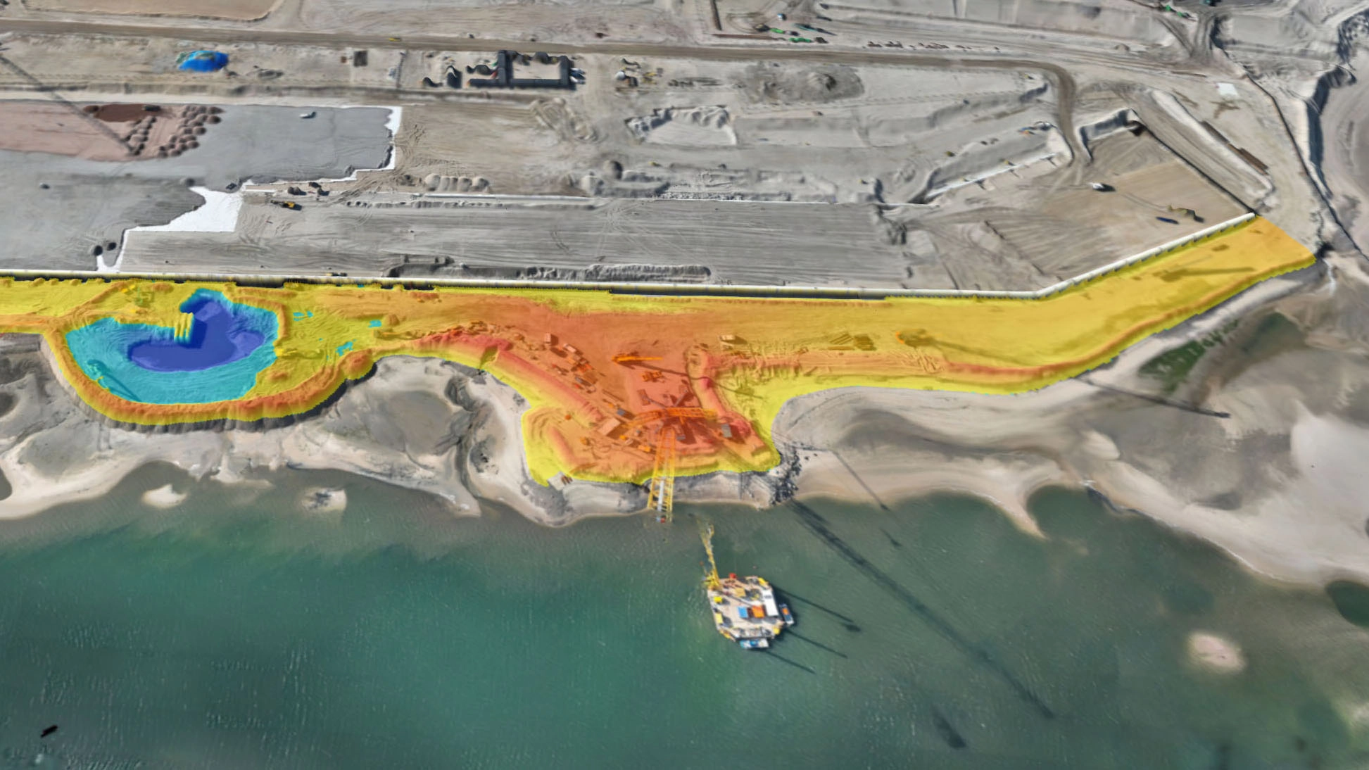
Our Topography Surveying service delivers accurate elevation data, contour maps, and digital terrain models using advanced drone photogrammetry. Our surveys achieve centimeter-level accuracy, providing the detailed topographic information you need for site planning, earthwork calculations, drainage design, and regulatory compliance - completed in a fraction of the time of traditional ground surveys.
Detailed contour line maps at customizable intervals (e.g., 0.5m, 1m, 2m) showing elevation changes across your site in industry-standard formats.
High-resolution DTM and DSM (Digital Surface Model) deliverables showing bare-earth elevations and surface features with centimeter accuracy.
Georeferenced, distortion-free aerial imagery mosaics that serve as accurate base maps for design and planning work.
Deliverables in formats compatible with AutoCAD, Civil 3D, ArcGIS, and other industry-standard design and GIS software (DWG, DXF, GeoTIFF, LAS).
Complete topographic surveys in hours instead of days or weeks, covering large or difficult-to-access areas quickly and safely.
Significantly reduce survey costs compared to traditional ground-based methods, especially for large sites or repeat surveys.
Achieve centimeter-level accuracy suitable for site planning, earthwork design, and regulatory submissions when using ground control points.
Eliminate the need for surveyors to access hazardous terrain, steep slopes, or active construction zones during data capture.
We determine accuracy requirements, coordinate systems, and deliverable formats. Ground control points (GCPs) are planned if survey-grade accuracy is needed.
For maximum accuracy, we establish and survey ground control points across your site using RTK GPS equipment.
Our pilots execute automated flight missions capturing overlapping nadir (straight-down) images with precise GPS coordinates for each photo.
Professional software creates georeferenced orthomosaics, digital terrain models (DTM), and digital surface models (DSM) from the aerial imagery.
Contour maps, CAD files, GIS datasets, and reports are generated in your required formats and coordinate systems, ready for immediate use.
Replace slow, expensive traditional surveys with fast, accurate drone-based topography that delivers survey-grade results in a fraction of the time
Get Your Free Quote View Our Work